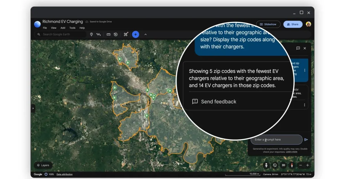
Google Earth is revolutionizing the way we interact with data through enhanced AI features. Users can now chat with AI models to identify infrastructure at risk and monitor environmental changes like algae blooms, all thanks to the new Gemini capabilities.
Hurricane Humberto has rapidly intensified into a Category 4 storm, currently posing no threat to South Florida. However, residents should stay informed as conditions may change and marine hazards are expected.
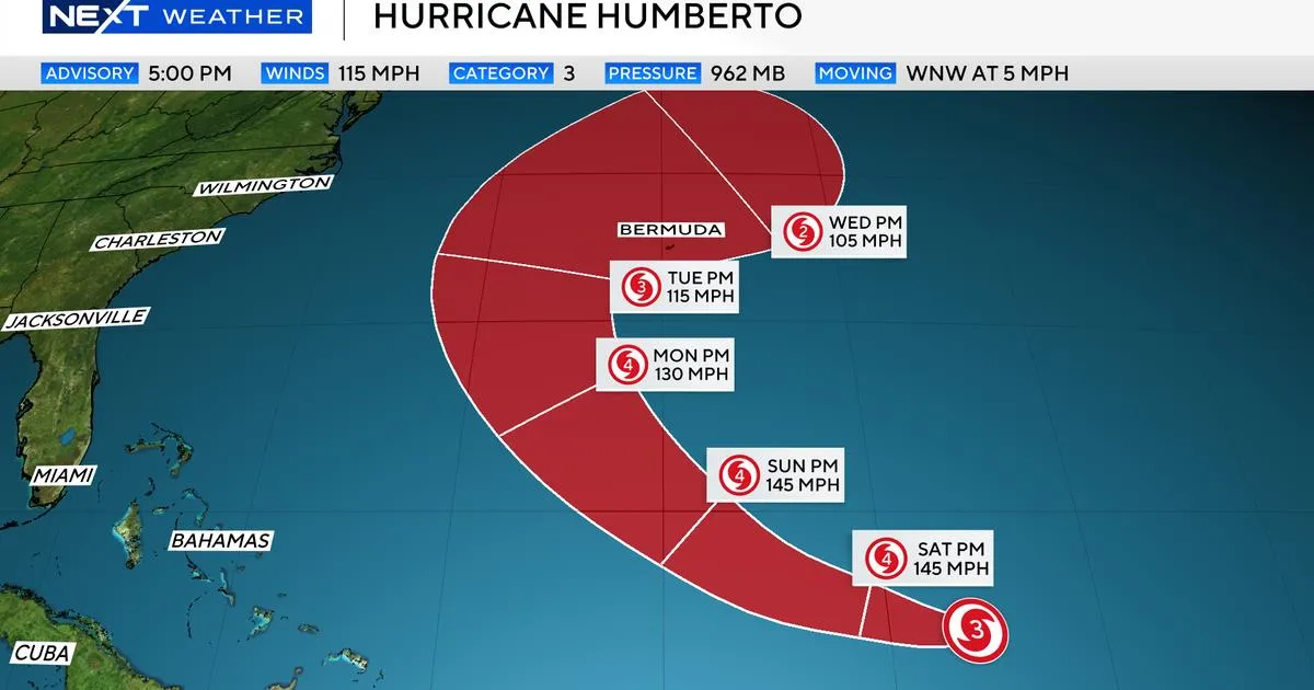
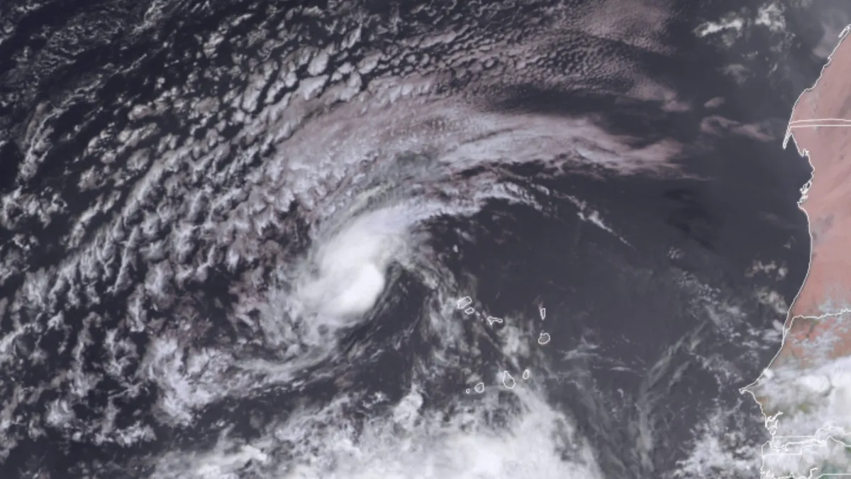
The Atlantic is heating up with Hurricane Gabrielle on a collision course with the Azores, while Tropical Storm Humberto could evolve into a major hurricane. Residents in the Southeast should stay vigilant as new storm systems emerge.
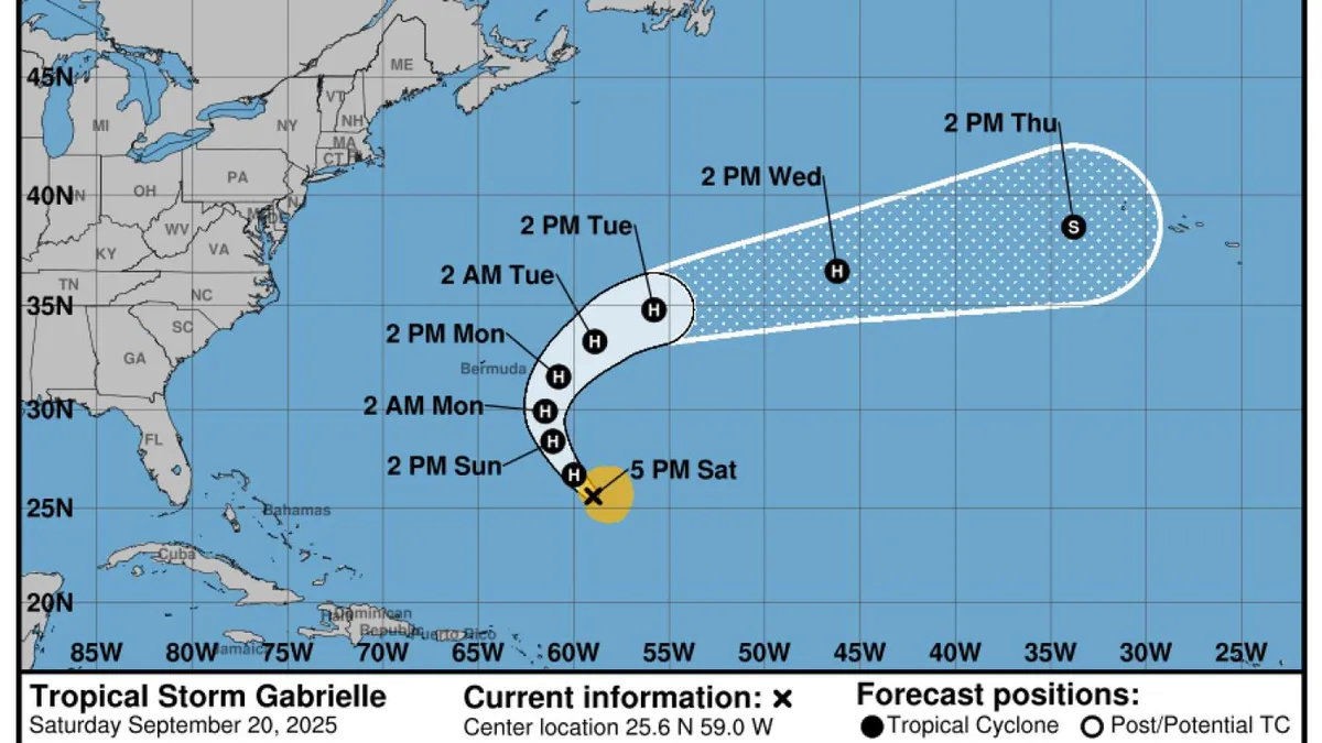
Tropical Storm Gabrielle could become a hurricane as early as Saturday night, with winds reaching up to 105 mph. While Bermuda may escape a direct hit, dangerous surf conditions are expected.

Hurricane Erin, a powerful Category 2 storm, is set to impact a dozen states with dangerous surf and possible flooding from Wednesday to Friday. Stay informed about weather alerts in your area!
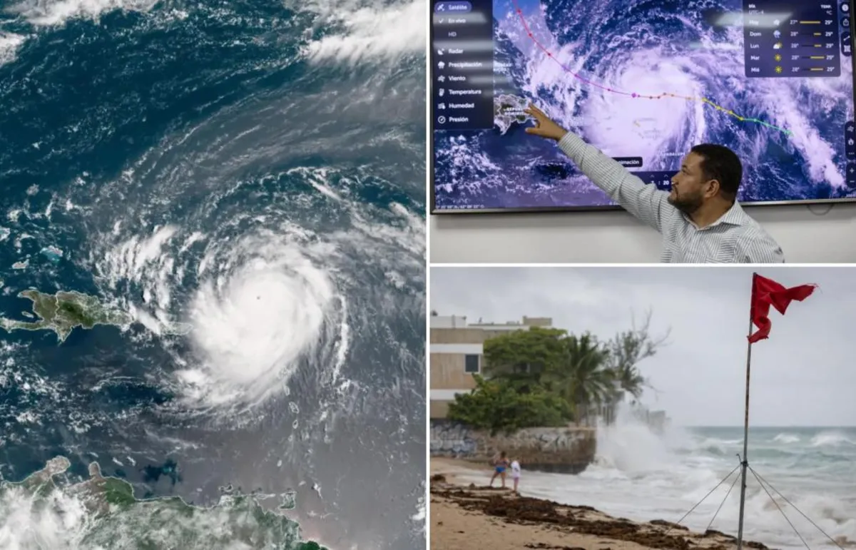
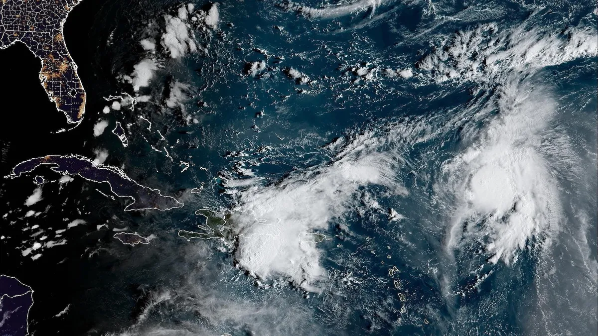
Hurricane Erin has rapidly intensified into a dangerous Category 5 cyclone, bringing heavy rains and potential flooding to the northern Caribbean islands. As it weakens slightly to a Category 4, authorities warn of flash floods and mudslides.
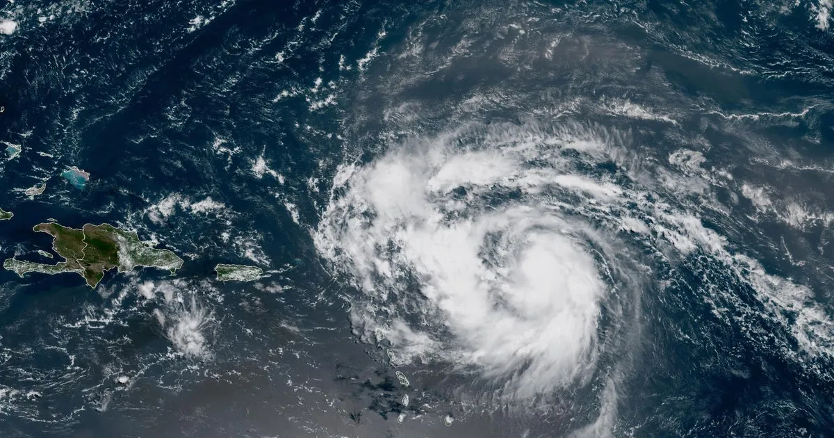
Hurricane Erin has officially strengthened into a Category 1 hurricane, marking the first of the Atlantic season. Forecasters warn Caribbean islands to brace for potential heavy rainfall and dangerous surf conditions as the storm gains strength.
Tropical Storm Erin is on track to potentially become this season's first hurricane, with forecasters monitoring its path closely. While a direct strike to the U.S. is unlikely, areas like Bermuda and the Bahamas could face impacts. Stay informed!
Tropical Storm Erin is on a path to potentially become a major hurricane, with forecasts predicting intensification as it travels across the North Atlantic. With conditions favorable for development, Erin could impact the Atlantic coast and Bermuda in the coming week.

Tropical Storm Erin has formed in the eastern Atlantic and is on track to potentially become the season's first hurricane. Forecasters predict it may strengthen as it approaches the Caribbean by week's end. Stay tuned for updates!