Hurricane Erin intensified into a hurricane on Friday, marking it as the first hurricane to form in the Atlantic during the 2023 season. According to forecasters, Erin is expected to continue gaining strength, with the potential to develop into a major hurricane. The U.S. National Hurricane Center in Miami has been actively urging residents in the Caribbean islands to closely monitor Erin's progress, highlighting the risks of heavy rainfall and life-threatening surf and rip current conditions.
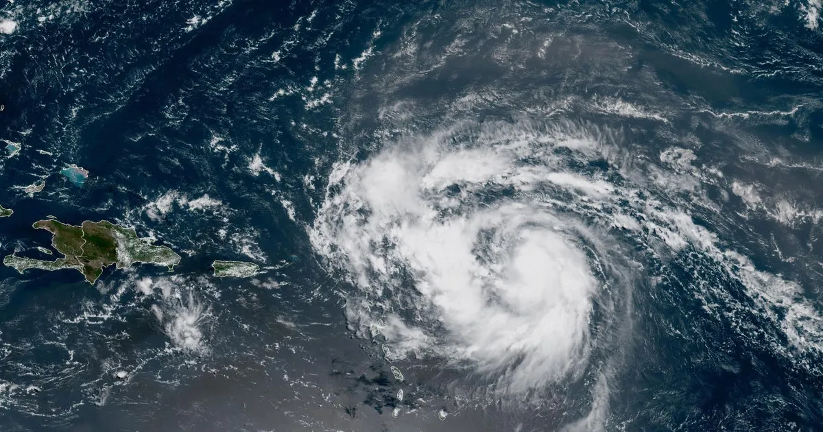
As of 11 a.m. EDT, Hurricane Erin was located approximately 460 miles east of the northern Leeward Islands, moving west-northwest at 18 mph. The storm is exhibiting maximum sustained winds of 75 mph, placing it in the Category 1 hurricane classification. Meteorologists are closely monitoring Erin’s trajectory, which is projected to curve northward, possibly passing near the northern Leewards over the upcoming weekend.
The northern Leeward Islands, which span from the Virgin Islands to Guadeloupe and include destinations like St. Martin and St. Barts, are on high alert. Forecast models, often referred to as "spaghetti maps," suggest that Hurricane Erin will likely skirt these islands, remaining well offshore of the U.S. East Coast. While the current forecast does not indicate a direct impact on the United States, the situation remains fluid, and updates will be provided as the storm evolves.
Hurricane Erin is anticipated to continue strengthening, with expectations to evolve into a major hurricane, classified as a Category 3 or higher, characterized by sustained winds of 111 mph or more. This forecast aligns with the typical pattern of the Atlantic hurricane season, which generally sees increased activity as it approaches its peak in September.
Hurricane Erin originated as a tropical storm on Monday, forming west of the Cabo Verde islands, which are located several hundred miles off the western coast of Africa. This storm marks the fifth named storm of the 2023 Atlantic hurricane season, which commenced in June and will conclude in November. To date, Tropical Storm Chantal is the only storm that has made landfall in the United States, resulting in severe flooding in North Carolina in early July. Additionally, the tropical depression Barry impacted Mexico's eastern coast in June.
As the Atlantic hurricane season approaches its peak, the U.S. National Oceanic and Atmospheric Administration (NOAA) has forecasted an above-normal season, predicting between 13 and 18 named storms. Tropical storms are defined by having maximum sustained winds of at least 39 mph, while hurricanes have sustained winds of 74 mph or higher. NOAA anticipates that between five and nine storms this season could escalate into hurricanes, and forecasts suggest there could be between two and five major hurricanes in the Atlantic.
As we continue to monitor Hurricane Erin's path and potential impacts, it is crucial for residents of the Caribbean and coastal areas to stay informed and prepared for any developments.