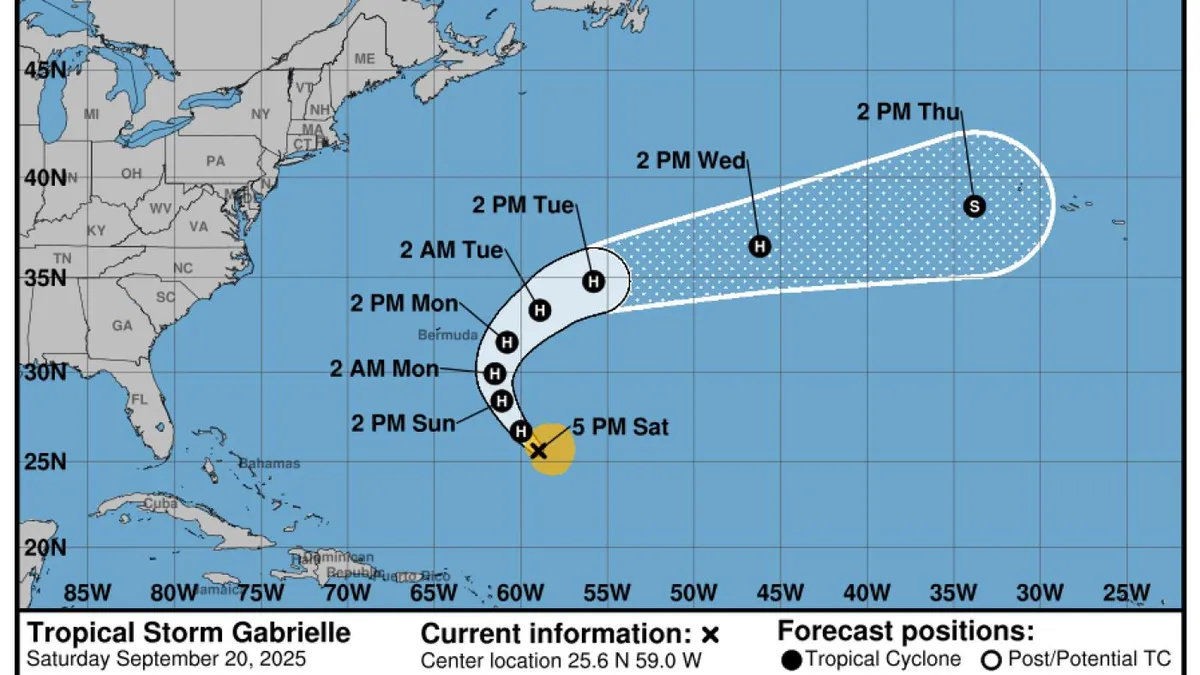
Tropical Storm Gabrielle is on track to strengthen into a hurricane as early as Saturday night, according to the latest updates from the National Hurricane Center. As of 5 p.m. ET on Saturday, Gabrielle was moving northwest in the Atlantic with sustained winds reaching 65 mph. The storm was located approximately 580 miles southeast of Bermuda.
Forecaster David Roth from the National Weather Service indicated that Gabrielle is expected to escalate, potentially achieving maximum sustained winds of up to 105 mph. This intensity would classify Gabrielle as a Category 2 hurricane. The National Hurricane Center anticipates that Gabrielle will pass east of Bermuda on either Sunday night or Monday. While a direct hit on Bermuda is not expected, residents should prepare for increased swells, which could lead to life-threatening surf conditions.
Bermudans may notice higher wave activity by Tuesday, with Roth noting that easterly winds could intensify on Sunday and Monday. It’s important to be cautious, as even minor wind conditions can lead to dangerous rip currents. Although Gabrielle is projected to skirt the U.S. mainland, swells may extend as far as the East Coast, particularly north of North Carolina.
After passing Bermuda, Gabrielle is forecasted to curve northeast toward the Azores. If the storm indeed strengthens into a hurricane, it would mark the second Atlantic hurricane of the season. Interestingly, this development is occurring nearly a month later than the average timeline, as the second hurricane typically forms around August 26, according to the National Hurricane Center.
As we approach the conclusion of the 2025 Atlantic hurricane season, which ends on November 30, monitoring storms like Gabrielle becomes increasingly crucial. The unexpected timing of this storm highlights the unpredictable nature of hurricane season and the importance of staying informed about weather developments.