Hurricane Erin, marking the onset of the 2025 Atlantic hurricane season, has rapidly intensified into an extremely dangerous Category 5 hurricane. Over the weekend, Erin maintained a safe distance from the Caribbean islands while exhibiting remarkable strength. Shortly after the hurricane began its rapid intensification phase, Hurricane Hunters confirmed that the storm's winds had escalated to a staggering 160 mph, categorizing it as a major cyclone on the Saffir-Simpson Hurricane Wind Scale.
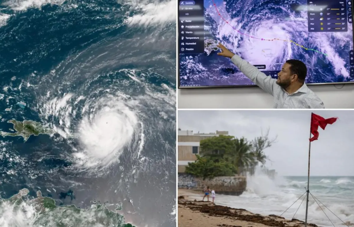
Since reaching its peak intensity, Hurricane Erin has slightly weakened to a Category 4 as it undergoes some reorganization. Despite this slight decrease in strength, the hurricane's outer bands have already begun impacting the northern Caribbean islands. Weather correspondent Robert Ray from FOX Weather has reported firsthand experiences from within the storm. Rain totals in the affected regions are anticipated to reach between 2 to 4 inches, with isolated areas possibly receiving up to six inches through Sunday. The National Hurricane Center has warned residents to prepare for “locally considerable flash and urban flooding,” as well as potential landslides or mudslides.
A Tropical Storm Watch is currently in effect for the Turks and Caicos Islands as well as the southeast Bahamas. The main core of Hurricane Erin is projected to pass north and east of these areas in the next 48 hours, although residents should remain vigilant as conditions can change rapidly.
Hurricane Erin was initially designated as a tropical storm on Monday after originating from an area of interest known as Invest 97L. Before it was officially named, Invest 97L brought devastating heavy rains to the Cabo Verde islands, resulting in multiple fatalities and significant flooding damage.
As of now, the 2025 Atlantic hurricane season has recorded four tropical storms: Andrea, Barry, Chantal, and Dexter, but Erin is the first to escalate into a hurricane. Meteorologists are keeping a close watch on additional developments in the tropics, particularly in the eastern and central Atlantic. Should cyclone formation occur, it is expected to remain far from land for the foreseeable future, with any potential development likely more than a week away.
The next tropical storm to be named in this active season will be Fernand, marking the sixth name of the year. The peak of the Atlantic hurricane season typically occurs around September 10, with the season concluding at the end of November. As we progress through this critical period, staying informed and prepared is crucial for those in hurricane-prone areas.