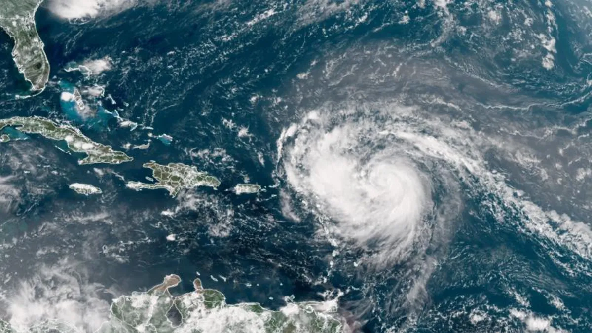
Hurricane Erin is rapidly intensifying as it tracks above the northeastern Caribbean on Saturday, creating rough surf and bringing gusty winds and rain to the islands situated south of its path. As of Saturday morning, the National Hurricane Center reported that Erin was classified as a Category 4 hurricane, boasting sustained winds of 130 mph. The storm is currently located about 150 miles northeast of Anguilla.
Erin is moving just north of the Leeward Islands, the Virgin Islands, and Puerto Rico this weekend while making a gradual turn toward the north. Fortunately, it appears unlikely that the storm will make a direct landfall on any of the northeastern Caribbean islands. Nevertheless, tropical alerts have been issued in some regions, cautioning residents about potential threats associated with the storm.
Forecasts indicate that Erin will continue to track north over the western Atlantic next week, moving away from the United States and Bermuda. However, it is important to note that this trajectory could change if the storm alters its path more or less sharply than currently predicted. Even if the forecast remains constant, Erin could still pose risks to both areas through rough surf and dangerous rip currents.
The storm is expected to continue strengthening throughout Saturday, energized by the warmer-than-normal Atlantic waters. By the middle of next week, Erin is anticipated to at least double or triple in size, which will likely lead to increasingly rough ocean conditions over the western Atlantic. Rapid intensification occurs when the winds swirling around a storm's center increase by at least 35 mph within a 24-hour period, and this phenomenon has been observed more frequently in recent years due to rising ocean temperatures caused by climate change. Last year alone, nine storms in the Atlantic basin, including Hurricane Helene and Hurricane Milton, experienced rapid intensification.
In anticipation of Hurricane Erin, the US Coast Guard captain for the port of San Juan has ordered that the ports of St. Thomas and St. John in the US Virgin Islands, along with six seaports in Puerto Rico, be closed to all inbound vessel traffic unless specifically authorized. As Erin continues its path, the islands will experience rough seas and rip currents extending into early next week. Gusty winds and rain—which may be heavy at times—are also affecting the islands as Erin passes by.
Some areas could see rainfall amounts of 2 to 4 inches this weekend, with localized totals potentially reaching up to 6 inches in the heaviest downpours. This intense rainfall poses a risk for flash flooding and mudslides, underscoring the need for caution in affected regions.
There is ample fuel in the region for Erin to draw upon, as sea surface temperatures remain much warmer than normal. While these temperatures are not quite at the record levels seen in 2023 and 2024, they are still significantly higher than what would be expected in a stable climate. Erin marks the first major hurricane of the Atlantic season. Prior to Erin, four other systems—Andrea, Barry, Chantal, and Dexter—traversed the Atlantic basin, but none reached hurricane strength.
The typical formation date for the season's first hurricane is around August 11, meaning Erin is slightly behind schedule, particularly when compared to the early arrivals of previous years. For instance, by August 15 last year, three hurricanes—Beryl, Debby, and Ernesto—had already formed. As we move through the month, there will likely be additional opportunities for tropical systems to develop. Long-term forecasts from the Climate Prediction Center indicate that the same area of the Atlantic where Erin formed will be closely monitored for new storm developments, at least into early September.