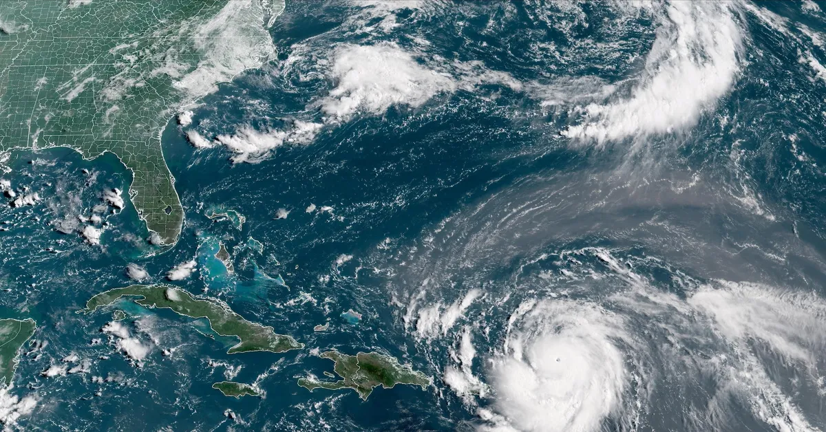
As of August 16, 2025, Hurricane Erin has emerged as the first hurricane of the 2025 Atlantic season, classified as a Category 4 storm by the U.S. National Hurricane Center (NHC). A recent update revealed that Erin's intensity has downgraded slightly from Category 5, with maximum sustained winds now at 140 mph (225 kph), a decrease from the previous peak of 160 mph.
The storm is currently positioned approximately 395 miles (636 km) east of Grand Turk Island and is advancing toward the west-northwest at nearly 14 mph. The NHC anticipates a shift in direction toward the north, expected to occur between Monday and Tuesday. Notably, the meteorological service of France has halted the tropical storm watch for St. Martin and St. Barthelemy, while the Netherlands has done the same for Sint Maarten.
Initially, the NHC predicted that Hurricane Erin would intensify as the week progresses. The hurricane's center is projected to pass north of the northern Leeward Islands, the Virgin Islands, and Puerto Rico through Sunday. Following this, the storm will likely move to the east of the Turks and Caicos Islands and southeastern Bahamas during Sunday night and into Monday.
Hurricane Erin is expected to bring heavy rainfall across the northern Leeward Islands, the Virgin Islands, and Puerto Rico through Sunday. Additionally, swells generated by the storm will impact regions including the northern Leeward Islands, the Virgin Islands, Puerto Rico, Hispaniola, and the Turks and Caicos Islands throughout the weekend. These swells are anticipated to extend to the Bahamas, Bermuda, and the East Coast of the United States early in the upcoming week.
The Bahamas, which provides meteorological services for the Turks and Caicos Islands, has issued a Tropical Storm Watch for the British islands located southeast of its territory. This watch reflects ongoing concerns regarding the potential impacts of Hurricane Erin.
In addition to its wind and rain, Hurricane Erin has raised alarms about increased wildfire risks. Senior Meteorologist Andrew Siffert from BMS Group indicated that if Erin transitions into a powerful offshore storm, it could create conditions favorable for wildfires. This scenario would be particularly concerning if dry winds and human-caused sparks ignite the already parched vegetation.
In a statement released on Friday, insurance-linked securities manager Twelve Securis noted that Hurricane Erin is projected to remain sufficiently offshore, which may minimize significant impacts on the U.S. East Coast. This forecast provides a degree of relief to coastal residents and businesses who are closely monitoring the storm's progression.
As Hurricane Erin continues its path across the Atlantic, updates from the NHC and local meteorological services will be crucial in understanding its potential impacts and necessary precautions for those in affected regions.