Recent weather patterns, characterized by warm water and unusual atmospheric conditions, have led to devastating rainfall in Washington state. Over the past week, meteorologists report that almost 5 trillion gallons (19 trillion liters) of rain have fallen, raising concerns about record flood levels. The persistent heavy rains are expected to continue through late Thursday and early Friday morning, before the flow of moisture begins to lessen and shift.
At the heart of this weather phenomenon are atmospheric rivers, which are long, narrow bands of water vapor that form over oceans. These systems transport moisture from tropical regions to northern latitudes, and the Pacific Northwest experiences more of these events than other parts of the West Coast, according to experts. However, the current atmospheric river event is notably larger than typical occurrences.
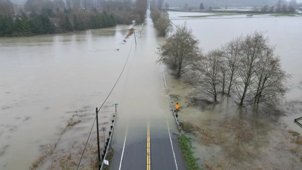
The intense downpours experienced on Wednesday, coupled with earlier rains on Monday, have led to dire forecasts of record-setting flooding, particularly for the Skagit River. This river flows through northern Washington and empties into the Puget Sound. Washington state climatologist Guillaume Mauger has highlighted the risks associated with this significant rainfall event.
Former NOAA chief scientist Ryan Maue, now a private meteorologist, described the current situation as extreme, estimating that rainfall could total between 20 to 30 inches (51 to 76 centimeters) over a three-week period. He noted that almost 5 trillion gallons of rain fell in the area last week alone, a volume sufficient to fill Oregon’s Crater Lake or more than 18,000 Empire State Buildings. One weather station at Mount Rainier recorded an astonishing 21 inches (53 centimeters) of rain since Thursday, highlighting the severity of this event.
The moisture fueling this atmospheric river originated a few hundred miles north of Hawaii, where sea surface temperatures are a couple of degrees warmer than normal. This warmth enhances the atmospheric river's capacity to carry moisture, with meteorologist Jeff Masters from Yale Climate Connections noting that warmer temperatures result in more rain than snow.
This extreme weather is not an isolated incident; it is part of a broader pattern influenced by global climatic changes. Maue pointed out that the chain of events leading to these storms began with deadly flooding from tropical cyclones near Indonesia. These events coincided with the Madden Julian Oscillation, a natural weather pattern that has been particularly strong this year, sending waves of moisture and energy toward the Americas.
A high-pressure ridge off the California coast has redirected this atmospheric river northward, further intensified by unusual warmth over Russia and cold conditions in Alaska. In a world increasingly affected by climate change, studies indicate that atmospheric river storms are becoming larger and wetter. Research from earlier this year suggests that since 1980, the area affected by these storms has increased by 6% to 9%, with frequency rising by 2% to 6% and precipitation levels slightly higher than before.
Climate Central's quick analysis found that ocean temperatures beneath these atmospheric rivers are now ten times more likely to be warmer than normal due to human-induced climate change. Additionally, air temperatures in the Pacific Northwest are significantly higher than average, with these conditions being four to five times more likely attributable to climate change, as noted by Climate Central meteorologist Shel Winkley.
The ongoing atmospheric river event in Washington state serves as a stark reminder of the implications of climate change on weather patterns. As meteorologists continue to monitor the situation, the potential for record flooding looms large, underscoring the need for preparedness and awareness in the face of such extreme weather events.