Federal forecasters are sounding the alarm for residents and tourists along the East Coast as Hurricane Erin progresses northward, bringing with it dangerous waves and severe weather conditions. As of 11 a.m. ET, the massive storm was located approximately 365 miles from Cape Hatteras, N.C., and its effects are expected to reach the shoreline starting Wednesday. This includes strong winds and the potential for flooding in areas like North Carolina and Virginia, as well as life-threatening rip currents anticipated in several states.
In light of the impending severe weather, beachgoers are strongly urged to heed advice from lifeguards, local authorities, and the beach warning flags posted along the shore. The National Hurricane Center has emphasized that the best course of action is to stay out of the water during this hazardous period.
Mandatory evacuations have already been issued for certain parts of North Carolina's Outer Banks, which are set to experience inclement weather conditions beginning later on Wednesday. In response to the storm, North Carolina Governor Josh Stein has declared a state of emergency, and a storm surge warning is currently in effect from Cape Lookout to Duck.
Additionally, areas of North Carolina and Virginia are under tropical storm warnings and watches, while Bermuda is also facing a tropical storm watch. The significant size of Hurricane Erin, which is producing tropical storm-force winds extending up to 265 miles from its center, means that its effects could be experienced far from the storm's eye. This includes anticipated swells and rip currents affecting beaches not only along the East Coast but also in Atlantic Canada, the Bahamas, and Bermuda.
The National Hurricane Center has warned that these rough ocean conditions will create life-threatening surf and rip currents. Rip currents are powerful, narrow channels of fast-moving water that pose a serious danger to swimmers attempting to return to shore. To safely navigate a rip current, the National Ocean Service recommends that swimmers swim parallel to the coastline and then at an angle back to shore.
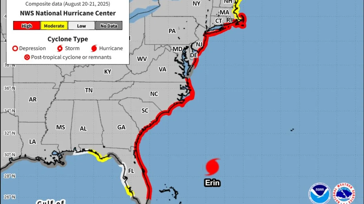
An NHC map has indicated a high risk of rip currents on Wednesday stretching from Florida to Massachusetts. Forecasters predict that Hurricane Erin may strengthen over the next day but should begin to weaken by Friday, although it is expected to remain a hurricane into the weekend.
As Hurricane Erin continues its path northward, it is crucial for individuals in affected areas to stay informed and prioritize safety. Following local advisories and remaining vigilant can significantly reduce the risks associated with this powerful storm.