As winter approaches, frigid temperatures are set to affect much of the central and eastern United States in the following weeks. According to AccuWeather, the first of three anticipated polar vortex systems is on the horizon this month. These surges of Arctic air are expected to generate rounds of flurries and squalls in certain locations and may even trigger storms that bring more widespread snowfall.
This week's outbreak marks the initial phase of what could be three significant cold rounds. AccuWeather's Lead Long-Range Meteorologist, Paul Pastelok, indicates that another cold blast is likely to follow next week, with a third expected the week after that. These waves of Arctic air will lead to significant surges in energy demands across affected regions.
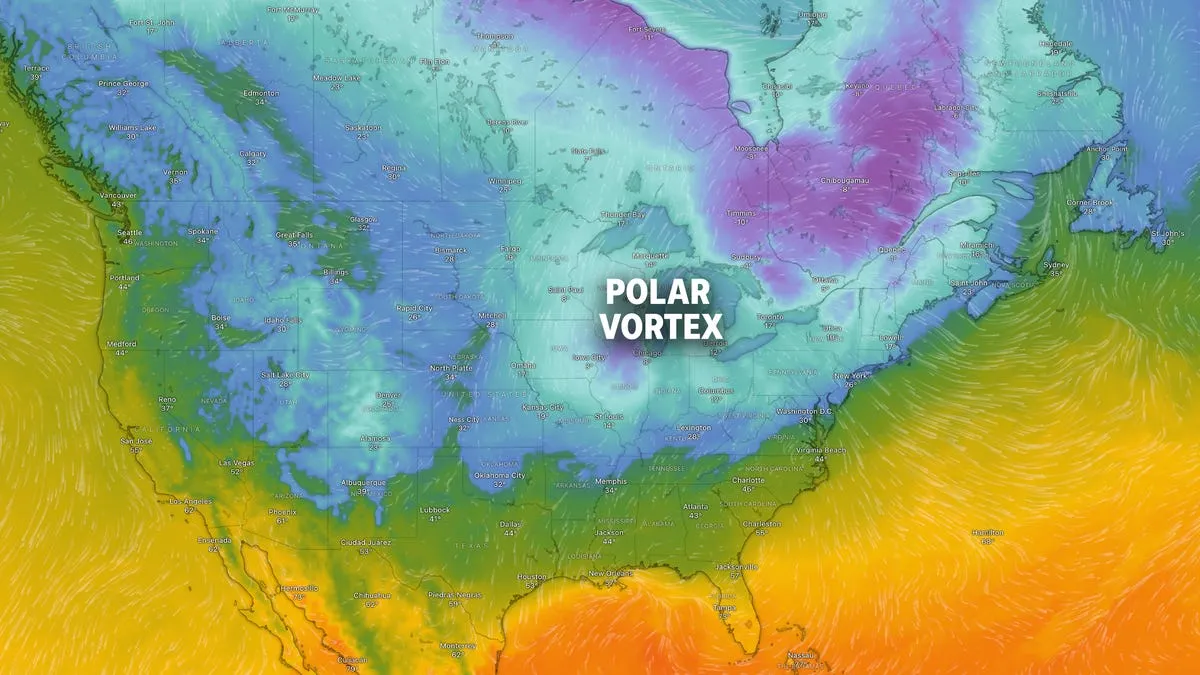
The Upper Midwest and Northern Plains have already begun to feel the effects of Canada's freezing temperatures. On Thursday, December 4, wind chills are projected to drop between negative 10 to negative 25 degrees Fahrenheit. These cold temperatures are anticipated to persist into Friday, December 5, particularly for those in the eastern U.S.
As the leading edge of the Arctic air mass moves southward, areas may experience flurries, snow, and larger snow squalls accompanying the front as it sweeps across the Great Lakes region and into the northern half of the Appalachians.
But what exactly is a polar vortex? The polar vortex is a massive circular upper-air weather system that typically covers the North Pole. This phenomenon is a normal pattern that helps to contain the coldest weather close to the Arctic and is generally stronger during winter months. However, at times, a portion of the polar vortex may break off or drift south, resulting in freezing weather conditions in the U.S., Europe, and Asia.
Usually, the jet stream helps to lock the vortex in place, preventing it from spreading its icy grip. However, when disruptions occur, it can lead to significant cold outbreaks in lower latitudes.
As temperatures begin to dip, the cold weather significantly elevates the risk of frostbite, particularly as temperatures approach or drop below freezing. The National Weather Service (NWS) employs computer modeling to provide a reliable and user-friendly formula for calculating wind chill. This index takes into account wind speed at five feet above the ground—the average height of an adult human face—while incorporating heat transfer theory based on heat loss from the body to its surroundings.
The wind chill index serves as a crucial guide for understanding how dangerously low temperatures combined with strong winds can lead to frostbite. To determine the wind chill temperature, one can consult the NWS chart, locating the relevant wind speed at the top and the outside temperature on the right. The wind-chill temperature will be found where these two values intersect.
Stay warm and safe during this winter season as the cold weather unfolds. For more updates and forecasts, keep an eye on reliable sources such as AccuWeather and the National Weather Service.
Contributing sources: Doyle Rice/USA TODAY, Cailey Gleezon, Milwaukee Journal Sentinel, AccuWeather, National Weather Service, and USA TODAY research.