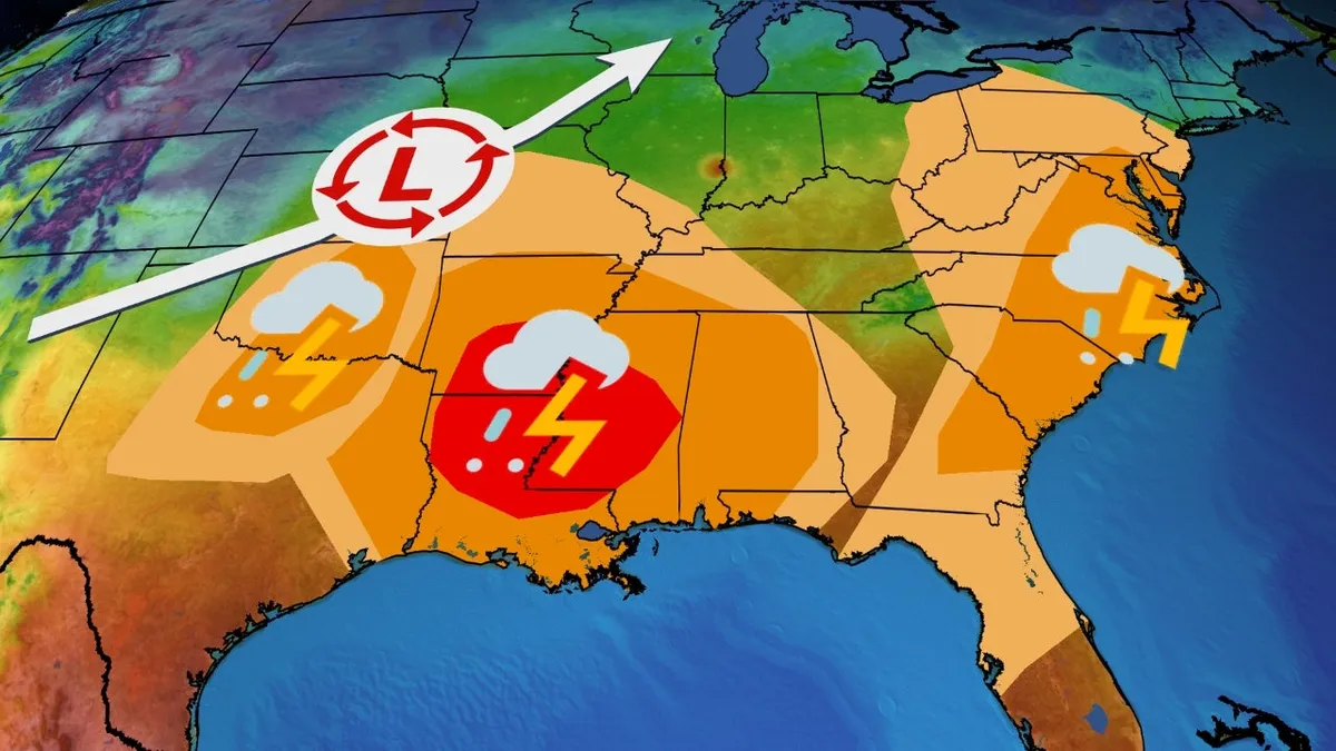
A powerful storm system is on the horizon, poised to unleash severe weather conditions that could result in tornadoes, damaging winds, and hail starting Monday night and continuing into Tuesday across the South. This severe weather is expected to advance towards the East Coast by Wednesday. Here’s a comprehensive overview of the timing and potential threats associated with this storm system.
The combination of an intensifying low-pressure system and rising Gulf moisture will create an environment conducive to severe weather starting Monday night. Areas particularly at risk include the Southern Plains, specifically central and eastern Oklahoma, as well as north-central Texas. Key cities like Oklahoma City, Tulsa, and the Dallas-Fort Worth area should be on heightened alert.
As storms develop, residents can expect large hail, damaging winds, and the possibility of tornadoes to accompany these severe thunderstorms.
On Tuesday and into Tuesday night, the National Oceanic and Atmospheric Administration (NOAA) has identified a significant threat for severe thunderstorms extending from eastern Texas and eastern Oklahoma to the lower Mississippi Valley, Alabama, and western Georgia. The most affected regions include Louisiana, Arkansas, and Mississippi, specifically cities like Jackson, Little Rock, and Shreveport.
Severe storms may persist throughout the morning in the western parts of the threat area, with the risk expanding eastward as the day progresses into the evening hours. For those wanting a more tailored forecast, our Premium Pro experience offers a detailed hour-by-hour breakdown for the next 8 days.
The severe weather threat may linger into Wednesday as the cold front approaches, impacting parts of the East Coast. Areas from Delaware and Maryland to far northern Florida, including Charleston, Raleigh, Richmond, and Washington, D.C., should remain vigilant. On this day, damaging winds and a few tornadoes are possible in these regions.
In addition to the severe thunderstorms, there is a risk of locally heavy rainfall across parts of the Midwest and South. This could lead to flash flooding, particularly in areas that have already experienced significant rainfall or flooding earlier in February, such as Kentucky and Tennessee. Fortunately, this storm does not appear to be a repeat of the slow-moving, heavy rain event from mid-February; however, some areas could still see over 2 inches of rain in a short period.
As this storm system approaches, it is crucial to have a severe weather safety plan in place. Ensure you have multiple ways to receive alerts from the National Weather Service, and familiarize yourself with safe shelter locations in the event of a tornado or severe thunderstorm warning. For the latest updates on this potential severe weather outbreak, be sure to check weather.com and download The Weather Channel app.