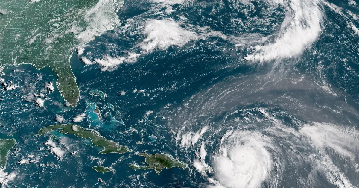
On August 16, the U.S. National Hurricane Center reported that Hurricane Erin, the first hurricane of the 2025 Atlantic season, has escalated to a catastrophic Category 5 hurricane. Currently, the storm is situated approximately 105 miles (170 km) north of Anguilla, exhibiting maximum sustained winds reaching up to 160 mph (255 km/h).
The National Hurricane Center indicated on Friday that Hurricane Erin is expected to continue strengthening as it moves through the southwestern Atlantic over the weekend and into the following week. This hurricane is generating significant swells that will affect various regions, including parts of the northern Leeward Islands, the Virgin Islands, Puerto Rico, Hispaniola, and the Turks and Caicos Islands throughout the weekend. According to the NHC, these swells are projected to reach the Bahamas, Bermuda, and the East Coast of the United States by early next week.
In addition to its immediate threats, Hurricane Erin has sparked worries about potential wildfires. Andrew Siffert, a senior meteorologist at BMS Group, pointed out that if Erin develops into a large, intense extratropical cyclone offshore, it could create a dangerous situation. This scenario is characterized by critically dry fuels in the region, powerful and dry winds resulting from Erin’s pressure gradient, and possible human ignition sources.
According to ILS investment manager Twelve Securis, Hurricane Erin is forecasted to remain sufficiently offshore, thereby reducing the likelihood of significant impacts on the U.S. East Coast. The storm is anticipated to pass north of the northern Caribbean Leeward Islands and then turn northward between the U.S. East Coast and Bermuda around Monday. The NHC has indicated that Erin will produce heavy rainfall across the northern Leeward Islands, the Virgin Islands, and Puerto Rico through Sunday, intensifying the need for residents in these areas to remain vigilant.
As the situation develops, it is crucial for individuals in the affected regions to stay informed and prepared for potential changes in the storm's trajectory and intensity.