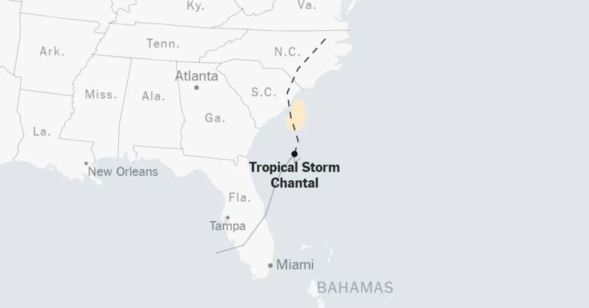
As Hurricane Chantal approaches, residents of the Carolinas should prepare for significant weather challenges. Regardless of when Chantal makes landfall, forecasts indicate that the storm is expected to bring heavy rain and an elevated risk of flash flooding through Monday. Meteorologists predict that the Carolinas could receive between two to four inches of rain, with some areas potentially experiencing as much as six inches of rainfall. This rainfall poses a serious threat of flash flooding, which can occur rapidly and with little warning.
Additionally, forecasters have issued warnings about a possible storm surge of one to two feet, which could exacerbate flooding conditions along the coast. Since Wednesday, the storm has already begun to deliver rain to Florida as it progresses along the Southeastern coast, illustrating the widespread reach of its effects.
The Atlantic hurricane season began on June 1 and will continue through November 30. After a slow start, the season has seen the formation of two tropical storms thus far: Andrea, which formed on June 24 and dissipated within a day, and Barry, which emerged in the Gulf just off Mexico’s coast before making landfall on Sunday night.
This year, forecasters from the National Oceanic and Atmospheric Administration (NOAA) predict an above-average hurricane season, estimating between 13 to 19 named storms. Historically, the most destructive storms tend to form later in the summer months, raising concerns among experts that a major hurricane could make landfall in the United States this season.
Climate experts have voiced their concerns over the growing frequency and intensity of storms, suggesting that climate change is a significant factor. As global temperatures rise, the atmosphere can hold more moisture, allowing storms to produce greater amounts of rainfall. This phenomenon was starkly illustrated by Hurricane Harvey in Texas during 2017, where some areas received over 40 inches of rain in less than 48 hours.
Moreover, researchers have documented a trend where storms have slowed down, lingering over specific regions for extended periods, which can lead to prolonged and severe weather conditions. Last year was notably one of the most costly for hurricanes in the United States, with Hurricanes Helene and Milton causing approximately $113 billion in damages and contributing to over 250 fatalities.
In May, the Trump administration announced it would cease maintaining a database of billion-dollar disasters, a tool crucial for understanding and preparing for the impacts of severe weather events. The administration has also significantly reduced staffing at key agencies responsible for disaster planning and response, such as NOAA, the National Weather Service, and the Federal Emergency Management Agency (FEMA).
As we navigate this hurricane season, it is imperative for communities to stay informed and prepared. With the potential for severe weather events like Chantal, proactive measures can help mitigate the risks associated with flash flooding and storm surges, ensuring the safety and well-being of all residents.