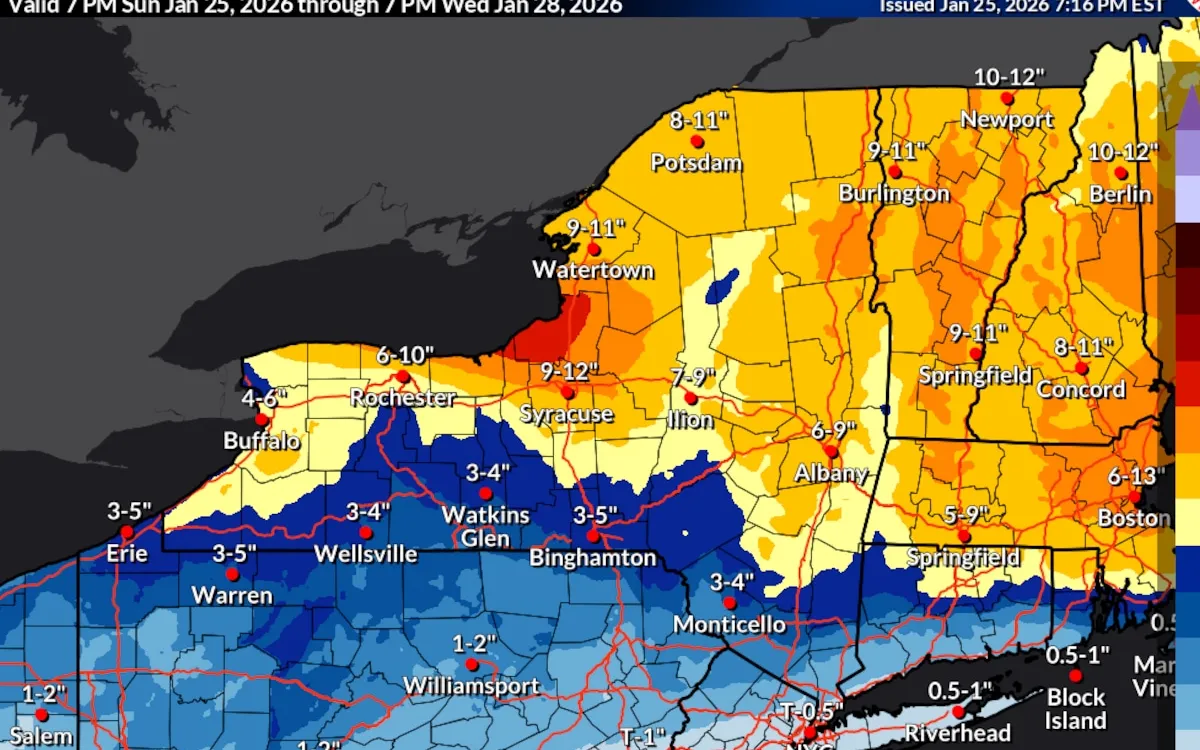
The National Weather Service has issued an updated winter storm warning for Central New York, predicting additional snow accumulations of between 4 and 8 inches. This warning comes as areas around Syracuse have already reported snow totals ranging from 6 to 8 inches as of 7 p.m. on Sunday. The warning is in effect until Monday at 7 p.m. for a total of 17 counties across the region.
According to the National Weather Service, snowfall rates could exceed 2 inches per hour through Sunday evening. As the storm progresses, residents should prepare for significant snow accumulation before the precipitation begins to taper off. Many local schools will be closed on Monday due to the severity of the weather conditions.
Throughout the storm, temperatures in Central New York are expected to hover in the upper single digits to teens. This cold snap will be accompanied by colder wind chills, making outdoor conditions particularly harsh. Winds are forecasted to gust as high as 35 mph on Monday afternoon, leading to areas of blowing and drifting snow, which could further complicate travel and outdoor activities.
On Monday evening, residents can anticipate lake effect snow showers coming off Lake Ontario. These showers are likely to impact the New York Thruway corridor, adding to the snowfall totals. An additional 1 to 2 inches of snow is possible by Monday night, further emphasizing the need for caution during this winter storm.
Stay updated with the latest forecasts and prepare accordingly as Central New York braces for this significant winter weather event.