Satellites orbiting Earth play a crucial role in gathering images and measurements of various landscapes, including land, forests, cities, and coastal waters. These observations have been instrumental for scientists aiming to understand our planet's dynamics. However, the challenge lies in the integration of these images from diverse sources, complicating efforts to create a cohesive representation of environmental data. In response to this challenge, Google’s artificial intelligence (AI) unit, DeepMind, has recently unveiled a groundbreaking AI model known as AlphaEarth Foundations.
AlphaEarth Foundations acts as a “virtual satellite,” allowing researchers to generate highly detailed maps of our world in nearly real time. According to Christopher Brown, a research engineer at Google DeepMind, the model can map the planet “at any place and time.” This advancement means that researchers no longer need to depend solely on a single satellite's observations, significantly enhancing their capacity to monitor various environmental factors such as crop health, deforestation, and urban development. Google DeepMind emphasizes that this new model provides a solid foundation for geospatial data, enabling comprehensive analyses in environmental science.
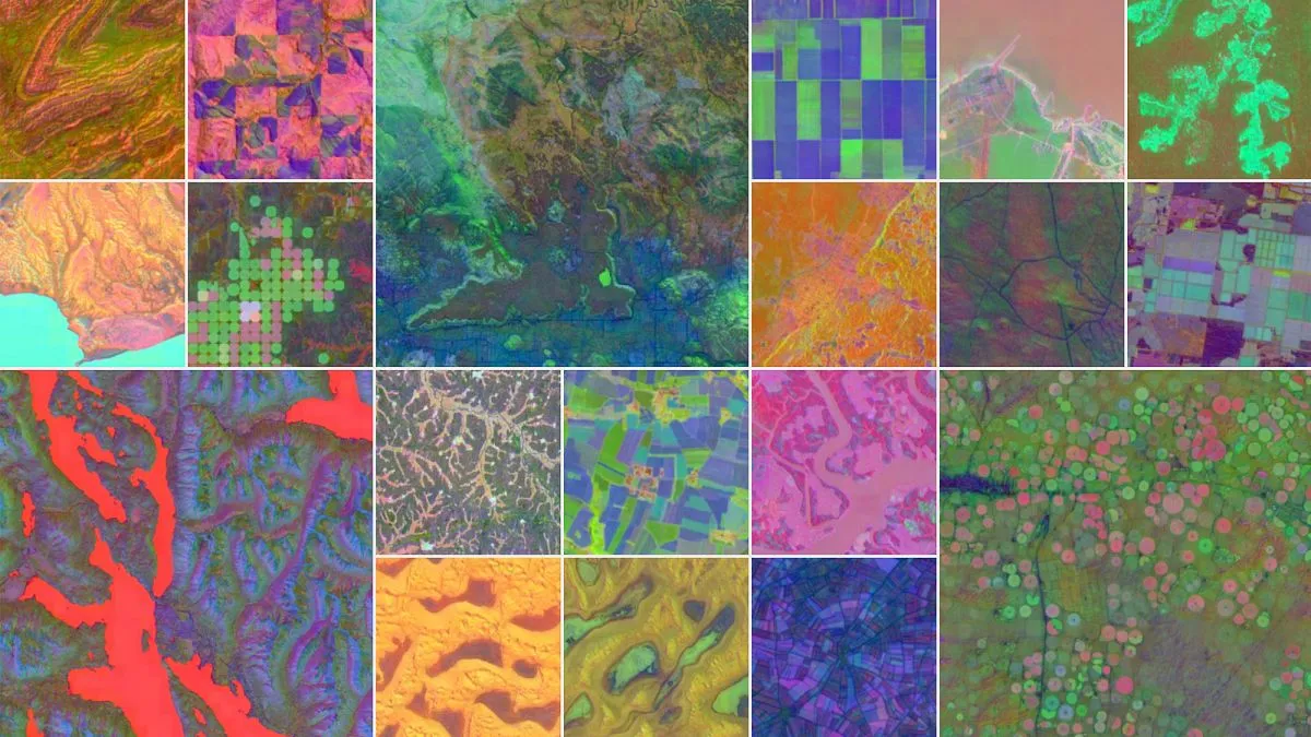
The innovative system combines trillions of images from a multitude of public sources, including satellite imagery, radar scans, laser-based 3D mapping, and climate simulations. This extensive dataset enables the model to map terrestrial land and coastal waters with remarkable precision. Google claims that AlphaEarth Foundations can produce accurate ecological data down to an area as small as 10 square metres. Furthermore, the data generated by this model occupies significantly less storage space compared to traditional AI systems, making large-scale analyses more feasible and efficient.
During its initial testing phase, which analyzed data from 2017 to 2024, AlphaEarth Foundations demonstrated superior performance compared to similar AI models. It outperformed others in identifying land use and estimating surface properties, achieving an average error rate 24 percent lower than its competitors, as highlighted in a recent DeepMind publication. Google anticipates that this model will assist researchers in studying critical issues such as food security, deforestation, urban expansion, and water resources.
The emergence of AlphaEarth Foundations aligns with a broader trend in environmental science, where AI technologies convert the continuous stream of satellite data into practical tools for Earth study. The model’s high-resolution and regularly updated data empower researchers to measure environmental changes with precision, facilitating a better understanding of factors driving these transformations. For instance, in 2020, a collaborative effort between NASA and the University of Copenhagen successfully mapped 1.8 billion individual tree canopies across the Sahel and Sahara regions of West Africa using AI technology. Such an endeavor would have required millions of people years to complete without the capabilities provided by AI.
Building on this momentum, NASA’s Surface Water and Ocean Topography (SWOT) satellite has been operational since 2022, delivering high-definition measurements of oceans, lakes, reservoirs, and rivers, covering over 90 percent of the global surface. NASA's Jet Propulsion Laboratory (JPL) states that SWOT can observe water bodies with ten times the resolution of existing technologies. Additionally, the European Space Agency (ESA) launched the EarthCARE satellite in 2024, focusing on how atmospheric clouds and particles affect Earth's temperature.
Much of the data utilized by Google DeepMind’s AlphaEarth Foundations model is derived from long-standing missions conducted by NASA and ESA, including the Landsat and Moderate Resolution Imaging Spectroradiometer (MODIS) satellites, as well as the Sentinel fleet. Google reports that over 50 organizations worldwide have already tested the model for various applications, including ecosystem monitoring and urban planning. For example, the Brazilian environmental initiative, MapBiomas, is leveraging AlphaEarth Foundations’ data to gain deeper insights into agricultural and environmental changes, particularly within the Amazon rainforest. Tasso Azevedo, the founder of MapBiomas, remarked that the model's annual datasets have provided the team “new options to make maps that are more accurate, precise and fast to produce, something we would have never been able to do before.”
In an effort to promote further research and collaboration, Google is releasing the dataset through Google Earth Engine, the company’s environmental data platform. This initiative aims to encourage scientists, researchers, and environmentalists to explore and utilize the rich data generated by AlphaEarth Foundations, paving the way for enhanced understanding and management of our planet’s resources.