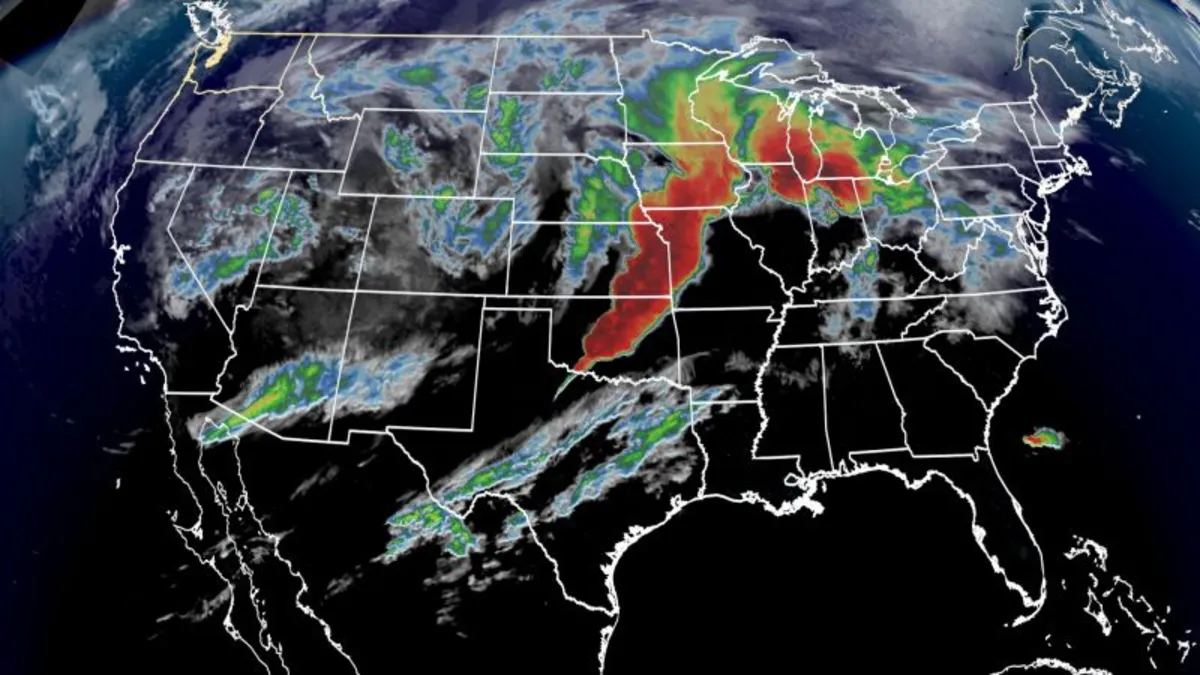
As a powerful spring storm sweeps across the central and eastern United States, a life-threatening outbreak of long-lived and strong tornadoes is anticipated today. This severe weather event follows a weekend of deadly storms and poses a significant risk to millions. Early Wednesday morning, severe thunderstorms were already impacting the Plains, setting the stage for heightened threats later in the day.
On Wednesday morning, a robust line of severe storms extended from Oklahoma to Missouri, prompting tornado warnings and resulting in multiple confirmed tornadoes overnight. The storms are expected to move eastward into the Mississippi Valley throughout the morning, intensifying the threat as the day progresses.
The Storm Prediction Center has indicated that a tornado outbreak is likely to occur in parts of the central and eastern United States. Over 20 million individuals, ranging from Louisiana to Ohio, could find themselves in the path of storms capable of producing strong tornadoes rated at least EF2. Alarmingly, numerous tornadoes, including long-track EF3 and greater tornadoes, are anticipated, with the most severe threat beginning later in the afternoon and extending into the night.
In addition to tornado threats, severe thunderstorms will bring heavy rainfall to the Mississippi and Ohio valleys starting late Wednesday. This marks the beginning of a significant multi-day flooding event, with forecasts predicting over 15 inches of rain by Saturday. Areas where Arkansas, Missouri, Illinois, Kentucky, and Tennessee converge are particularly at risk for life-threatening flooding.
The risk of severe thunderstorms and tornadoes today is at a rare level 5 of 5, particularly in parts of the Mississippi Valley. The storms are expected to produce widespread damaging winds, hail the size of baseballs, and strong, long-lived tornadoes. The greatest risk for tornado formation will arise in the afternoon and continue into the night, with storms potentially stretching from Louisiana and Arkansas northward to Michigan.
A stalled front in the atmosphere is set to channel a significant amount of moisture from the Gulf into the Mississippi and Ohio valleys, resulting in a prolonged flooding event. The National Weather Service has raised alarms about “generational rainfall amounts” that could lead to catastrophic flooding, prompting multiple flood watches in effect from Wednesday afternoon through Sunday morning across several states, including Arkansas, Tennessee, Kentucky, Indiana, Missouri, Mississippi, and Illinois.
The threat of flooding, categorized as a rare level 4 of 4, is particularly alarming. Such high-risk flooding events occur on fewer than 4% of days each year but are responsible for over 80% of flood-related damage and 36% of flood-related deaths, according to research from the Weather Prediction Center. With rainfall expected to accumulate rapidly, areas could see 2 to 6 inches of rain daily, leading to life-threatening flash floods.
The upcoming severe weather events are not unprecedented but are becoming increasingly common in a warming world. Rising global temperatures contribute to more intense and frequent rainfall, with nearly 90% of over 100 U.S. cities analyzed experiencing an increase in rainfall intensity since 1970. As we face these potent storms, it is crucial to stay informed and prepared for potentially devastating weather conditions.