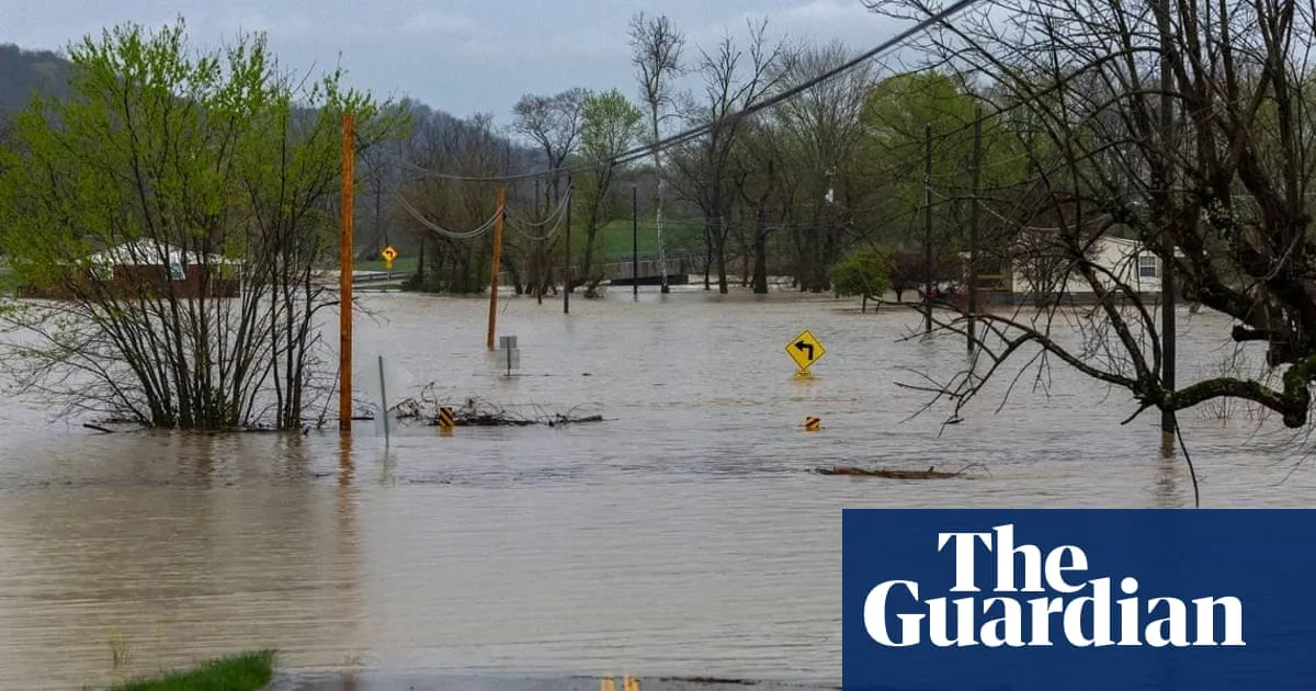
On Saturday, another round of torrential rain and flash flooding struck parts of the US South and Midwest, areas already suffering from extensive waterlogging due to days of severe storms. These storms have not only caused significant rainfall but also spawned deadly tornadoes, raising alarms among forecasters who warn that rivers in certain regions will continue to rise for days to come.
Day after day of heavy rains have relentlessly pounded the central US, leading to the rapid swelling of waterways and triggering a series of flash flood emergencies from Texas to Ohio. The National Weather Service (NWS) has predicted that dozens of locations across multiple states will reach major flood stages, raising concerns about extensive flooding of structures, roads, bridges, and other critical infrastructure.
Since the onset of these storms, at least 16 weather-related deaths have been reported, with 10 of those fatalities occurring in Tennessee alone. One tragic incident involved a 57-year-old man who died on Friday evening after exiting a vehicle that was swept off a roadway in West Plains, Missouri. In Kentucky, flooding claimed the lives of two individuals: a 9-year-old boy who was swept away while heading to school and a 74-year-old whose body was discovered in a fully submerged vehicle in Nelson County.
Additionally, on Saturday, a 5-year-old child died in a weather-related incident at a home in Little Rock, Arkansas, although details about the incident remain scarce. Earlier in the week, tornadoes wreaked havoc, destroying entire neighborhoods and resulting in at least seven deaths.
The severe flooding has also impacted interstate commerce. The extreme conditions across a corridor that includes major cargo hubs in Louisville, Kentucky, and Memphis could potentially lead to significant shipping and supply chain delays. Jonathan Porter, chief meteorologist at AccuWeather, highlighted these concerns as flooding escalates.
Louisville Mayor Craig Greenberg reported that the Ohio River rose five feet (approximately 1.5 meters) within just 24 hours and is expected to continue swelling for days. “We expect this to be one of the top 10 flooding events in Louisville history,” he stated. Flash flood emergencies and tornado warnings remain active across Arkansas, Mississippi, and Tennessee, with additional heavy rains and damaging winds in the forecast.
In north-central Kentucky, emergency officials have ordered a mandatory evacuation for Falmouth, a town of 2,000 residents located in a bend of the rising Licking River. These warnings echo those from nearly 30 years ago when the river surged to a record height of 50 feet (15 meters), resulting in five fatalities and the destruction of 1,000 homes.
In Arkansas, weather officials have urged residents to avoid travel unless absolutely necessary due to widespread flooding. BNSF Railway confirmed that a railroad bridge in Mammoth Spring was washed out by floodwaters, leading to the derailment of several cars. Fortunately, no injuries were reported, but there is currently no estimate for when the bridge will be reopened.
Since Wednesday, parts of Kentucky have received over a foot of rainfall (30.5 centimeters), while areas in Arkansas and Missouri have seen more than 8 inches (20 centimeters) of rain. Forecasters attribute the violent weather patterns to a combination of warm temperatures, an unstable atmosphere, strong wind shear, and abundant moisture originating from the Gulf.
On Friday evening, at least two tornadoes were reported in Missouri and Arkansas, according to the National Weather Service. One tornado, near Blytheville, Arkansas, lifted debris to an impressive height of 25,000 feet (7.6 km), as confirmed by NWS meteorologist Chelly Amin. The state’s emergency management office reported damage across 22 counties due to tornadoes, wind, hail, and flash flooding.