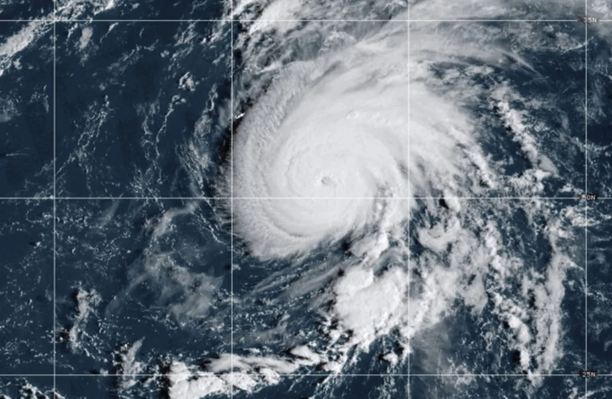
On Monday, residents of the Azores archipelago were cautioned to closely monitor the progress of Hurricane Gabrielle, which has intensified into a Category 4 hurricane in the Atlantic Ocean, according to the latest advisory from the National Hurricane Center. As of Monday afternoon, Gabrielle recorded maximum sustained winds of 140 mph (220 kph) while moving east-southeast of Bermuda.
At its current position, Hurricane Gabrielle is located approximately 180 miles (290 kilometers) from Bermuda and is advancing to the north-northeast at a speed of 12 mph (19 kph). Despite being over 2,000 miles (3,230 kilometers) away from the Azores, weather forecasters indicate that the system is expected to continue its path north and east over the coming days, potentially approaching the islands by the end of the week.
In the advisory issued by the hurricane center, meteorologists noted that little to no change in wind strength is anticipated for Hurricane Gabrielle on Monday night. However, they predict that the storm may gradually weaken on Tuesday and Wednesday. Additionally, forecasters expect the hurricane's forward speed to increase in the next 48 hours. Gabrielle had initially formed as a Category 1 hurricane on Sunday before rapidly intensifying in the warm waters of the Atlantic.
The storm's trajectory has led it to pass east of Bermuda, where swells from the hurricane began impacting the area on Sunday. These swells have also reached the U.S. East Coast, affecting regions from North Carolina up to Canada’s Atlantic coast. Forecasters have warned that these swells are likely to create “life-threatening surf and rip current conditions,” posing a significant danger to beachgoers and marine activities.
This year’s Atlantic hurricane season has been relatively calm, with Gabrielle being only the second named hurricane to emerge in the region. Experts attribute this unusual quietness to various meteorological conditions, although they caution that it does not imply that more dangerous storms won’t develop as the season progresses. The Atlantic hurricane season is set to conclude on November 30.
In related news, a separate weather system, Tropical Storm Narda, formed offshore of Mexico on Sunday. Forecasters predict that coastal regions could see up to 4 inches (10 centimeters) of rain by Monday night. The hurricane center reported that Narda currently has sustained winds of approximately 60 mph (97 kph) and is expected to strengthen into a hurricane by Tuesday. At present, Narda is located about 195 miles (314 kilometers) south of Manzanillo, Mexico, and is moving west-northwest at 13 mph (20 kph). The storm is anticipated to shift further westward into the ocean on Monday night.