A winter storm watch has been officially issued, beginning Friday night, due to an impending snowstorm expected to bring significant snowfall of 10 inches or more across the region this weekend. As the storm approaches, the chances of snow will increase late Friday night, transitioning into the early hours of Saturday.
From sunrise on Saturday through Saturday night, residents can expect periods of heavy snow accompanied by blowing snow, which may create dangerous travel conditions on local roads. This inclement weather is likely to result in potential delays at airports, making it imperative for travelers to stay informed about flight statuses.
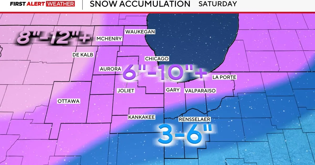
The forecast indicates that most locations will receive between 6 to 10 inches of snow, with the possibility of locally higher amounts exceeding 10 inches, depending on the storm's exact path. As this remains an evolving forecast, updates and adjustments are anticipated as the storm draws closer. It is crucial to stay tuned for the latest information regarding snowfall totals and travel advisories.
Given the expected conditions, significant travel impacts are anticipated throughout the weekend. Confidence is growing that many areas will experience snowfall of more than 6 inches, with isolated regions potentially seeing totals of 10 inches or more. Snowfall rates could reach approximately an inch per hour, further complicating travel.
In some areas to the south, a rain/snow mix may occur, which could affect snow totals in those regions. Following the storm's departure on Sunday, conditions are expected to turn very cold, with nighttime lows dropping near or below zero Sunday night and again early next week.
Residents are encouraged to prepare for the winter weather by staying informed, adjusting travel plans as needed, and prioritizing safety during this significant snow event. Keep an eye on local news sources for ongoing updates and guidance as the storm unfolds.