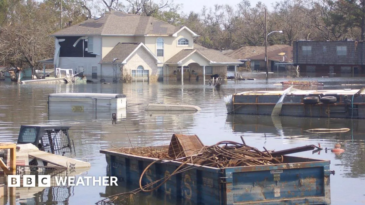
On the 20th anniversary of Hurricane Katrina, we reflect on the huge improvements in hurricane forecasting that have emerged since this catastrophic event struck New Orleans. Beginning as a mere cluster of storm clouds over the Bahamas, Hurricane Katrina evolved into the deadliest and costliest natural disaster in the history of the United States, claiming nearly 2,000 lives and causing over $100 billion in property damage. This tragic event was part of the most active Atlantic hurricane season on record, which left an indelible mark on the field of meteorology.
Hurricane Katrina's devastation was profound, with approximately 300,000 homes destroyed or rendered uninhabitable. Although the U.S. National Hurricane Center (NHC) accurately forecasted the storm's track three days in advance, the aftermath catalyzed a nationwide effort to enhance hurricane modeling, prediction, and warning capabilities.
Technological advancements have been the primary driver in improving hurricane forecast accuracy. The integration of satellites, aircraft observations, and numerical forecasting models, alongside historical weather data, now enables meteorologists to provide more reliable predictions. In 2005, satellite imagery was updated every 30 minutes; today, it is refreshed every 10 minutes, and during severe weather events, updates can occur as frequently as every 30 seconds.
Moreover, advancements in data collection methods have significantly enhanced research capabilities. For instance, unmanned drones are now utilized to gather crucial data about storm systems, which was not the case in 2005. With the advent of gliders, floats, and drifters, scientists can collect valuable information from the ocean's boundary layer—an area where the air meets the sea, which is critical for understanding hurricane dynamics.
Modern computer models can now account for forecast errors from the previous five years, leading to a remarkable reduction in tracking errors. In 2005, the average tracking error for a 48-hour forecast was 110 nautical miles (200 km); today, according to the U.S. National Oceanic and Atmospheric Administration (NOAA), this error margin has decreased by approximately 50 percent. However, accurately predicting a storm's intensity remains a formidable challenge, as small changes in atmospheric conditions can dramatically alter its strength.
A recent study suggests that two primary factors contribute to this unpredictability: vertical wind shear and atmospheric moisture. Vertical wind shear, which can disrupt storm formation, poses a significant challenge, while moisture fuels cloud development and storm intensification. The most unpredictable hurricanes tend to occur in conditions where moderate wind shear and moisture coexist.
Despite improvements in forecasting accuracy, communication remains a critical issue. Hurricane Sandy in 2012 serves as a poignant example; although forecasts were accurate, they were not effectively communicated to the public, resulting in significant loss of life. Dr. Leanne Archer from the University of Bristol emphasizes the importance of enhancing early warning systems, risk mapping, evacuation plans, and governance structures to ensure communities are prepared for future hurricanes.
The classification of hurricanes, based on the Saffir-Simpson Hurricane Wind Scale, can complicate public perception of danger. This scale categorizes hurricanes by their sustained wind speeds, ranging from Category 1 to Category 5. While strong winds can cause extensive damage, the greatest threat to life often stems from storm surges. Storm surge is the abnormal rise of water generated by a storm, which, when combined with high tides and waves, can lead to catastrophic flooding.
During Hurricane Katrina, a storm surge exceeding 8 meters inundated the Gulf Coast, breaching levee systems and flooding approximately 80 percent of New Orleans, with some areas submerged under more than 4 meters of water. This catastrophic event serves as a stark reminder of the dangers posed by hurricanes.
In the wake of such disasters, technology has evolved to enhance public safety. Since 2011, Wireless Emergency Alerts, including hurricane warnings, have been sent directly to mobile devices. However, it was not until 2017 that the NHC introduced a storm surge warning graphic to better inform the public.
As we commemorate the anniversary of Hurricane Katrina, it is crucial to recognize the strides made in hurricane forecasting and preparedness. Continued efforts in research, technology, and communication will be vital in ensuring that communities are better equipped to face the challenges posed by future hurricanes.