Southern California is preparing for its most significant storm in over a year, prompting fears of life-threatening debris flows in the Los Angeles area, which was recently ravaged by historic wildfires. This storm is part of a trio of winter storms hitting the US this week, bringing snow, ice, and rain nationwide.
The upcoming storm is predicted to be the "most significant" this winter in Southern California, bringing "very intense" rainfall, according to Ariel Cohen, a meteorologist with the National Weather Service in Los Angeles. Light rain will begin Wednesday, but the heaviest rainfall is expected on Thursday.
Areas in Los Angeles and Ventura counties, particularly those affected by the Palisades and Eaton fires, are under a Level 3 of 4 risk of flooding rainfall. Over 36 million people in California, including regions like San Francisco, Sacramento, and San Diego, face a Level 2 of 4 flooding risk.
The heavy rain poses an increased risk to areas recently burned by wildfires. Evacuation warnings have been issued for "areas within and near the Lake Fire burn scar" in Santa Barbara County. More warnings are expected in LA Fire zones as the storm progresses.
LA County Sheriff Robert Luna stated, "We expect we'll be conducting evacuations in certain high-risk areas identified." Sheriff Luna and his team have been informing residents in Altadena and Malibu Hills about potential mud or debris flows. Search and rescue teams, deputies, and helicopter crews are on standby to respond to the storm.
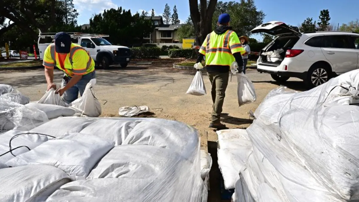
Efforts to mitigate the storm's impact include removing hazardous debris left by the fires. Los Angeles County has enhanced storm preparations by cleaning debris basins, installing concrete barriers, and placing sandbags in fire zones. More than 7,500 feet of concrete barriers and over 6,500 sandbags have been deployed in areas affected by the Palisades Fire.
Mayor Karen Bass emphasized, "Of course we're concerned about the Palisades and the burned areas, but this is for all of Los Angeles to be concerned about the rain and the impacts." The heaviest rain is expected from Thursday afternoon into early Friday, accompanied by damaging wind gusts that could down trees and power lines.
Another disruptive winter storm is affecting the eastern half of the US. Snow from a newly formed storm is impacting the Plains and Midwest, while a separate storm is bringing rain and ice to the East.
Chicago is experiencing its most substantial snowfall this winter, with up to 6 inches expected. Many schools in the Chicago area and other regions have closed or moved to online learning. Winter weather has also disrupted air travel, with numerous flight cancellations and delays reported.
Snow will reach the Northeast and persist through Thursday. Ice is expected to mix with snow in parts of Pennsylvania and New York, creating hazardous travel conditions. Light ice accumulations are possible from Oklahoma to the Ohio Valley and Northeast.
The storm is also intensifying rain and thunderstorms in the South. Flash flood warnings have been issued as storms move from Texas into Louisiana. Damaging storms are likely in southern Mississippi and Alabama, with a level 3 of 5 risk of severe thunderstorms.
Some thunderstorms could turn severe, potentially generating tornadoes from Louisiana to Georgia. The National Weather Service in Mobile, Alabama, warns of the potential for strong tornadoes, possibly forming after dark, making them particularly dangerous. A recent study found nighttime tornadoes are twice as likely to be deadly as those occurring during the day.