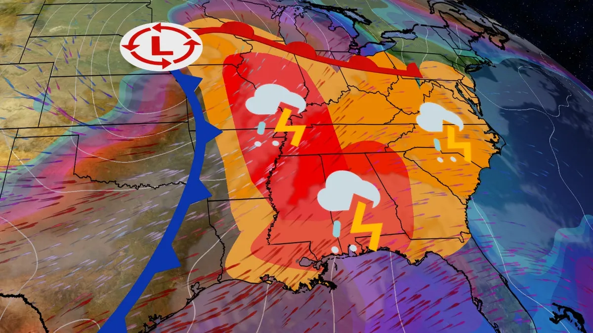
A powerful low-pressure system is poised to trigger a significant outbreak of severe thunderstorms across the Midwest, South, and East regions of the United States. This multi-day weather event raises concerns about tornadoes, widespread damaging winds, large hail, and flash flooding. Preparedness is key as forecasters predict that this storm system will impact central and eastern states from Friday through Sunday.
The storm system currently entering the West is expected to intensify, leading to hazardous weather conditions throughout the weekend. The Storm Prediction Center of the National Oceanic and Atmospheric Administration (NOAA) has highlighted specific areas at risk, so it is crucial for residents to stay informed and be ready for any alerts. Some areas may experience severe weather during the night, making it essential to know the nearest safe shelter and have multiple ways to receive warnings.
Locations: Much of the Mississippi Valley, along with parts of the lower Ohio and Tennessee valleys, is in the threat zone. Key cities such as St. Louis, Paducah (Kentucky), Memphis (Tennessee), and Jackson (Mississippi) are under heightened risk, particularly in areas shaded red by NOAA.
Timing: The threat of severe storms is expected to emerge later in the afternoon on the western edge of the forecast. As the evening progresses, the risk will spread eastward through the night, affecting the eastern sections of the threat zone.
Threats: Damaging wind gusts, potential tornadoes (possibly reaching EF2 strength or higher), and large hail are significant concerns. Tornadoes could form within a line of severe storms or develop from isolated supercells.
Locations: The Deep South faces the highest risk of severe storms, particularly in areas of Alabama, Georgia, Louisiana, Mississippi, Tennessee, and the western Florida Panhandle. Cities like Atlanta, Birmingham, Huntsville, and Montgomery in Alabama, as well as New Orleans, are at risk. Some severe weather may extend as far north as Ohio and western Pennsylvania.
Threats: The potential for tornadoes (possibly EF2 or stronger), numerous damaging wind gusts, and large hail are all significant threats. Additionally, flash flooding from heavy rainfall could affect parts of Alabama, Mississippi, northern Georgia, Tennessee, and Kentucky.
Locations: As the weekend concludes, the cold front may generate additional severe storms from the mid-Atlantic states to the Southeast, impacting cities like Charleston (South Carolina), Raleigh, Philadelphia, and Washington, D.C.
Timing: Some storms, potentially severe, may linger into the morning hours in parts of the East. The combination of ongoing storms intensifying and new storm development will sustain the threat of severe weather through the afternoon.
Threats: The primary concern will be damaging wind gusts, although isolated tornadoes cannot be ruled out. Localized flash flooding may also occur in various areas.
This severe weather pattern is typical for March and the spring season. A sharp southward plunge of the jet stream is moving from the West toward the central and eastern states. As this energy interacts with a strong low-pressure system along a cold front, it draws increasing moisture from the Gulf of Mexico. This combination creates the ideal conditions for the formation of numerous thunderstorms, some capable of rotation and producing tornadoes, alongside widespread damaging winds and hail.
Residents in the affected areas should remain vigilant, stay informed, and take the necessary precautions to ensure their safety during this severe weather outbreak.