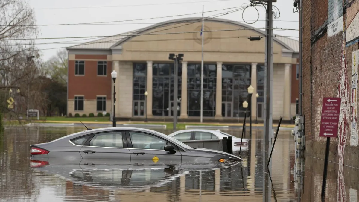
Hopkinsville, Kentucky is facing another round of torrential rain and flash flooding, as parts of the South and Midwest continue to struggle with severe weather conditions. These areas have already been heavily impacted by days of intense storms, which have unfortunately resulted in deadly tornadoes. The relentless rains have caused waterways to swell rapidly, leading to a series of flash flood emergencies in states such as Missouri, Texas, and Arkansas.
The National Weather Service (NWS) has warned that 45 river locations across multiple states are expected to reach major flood stage, which could lead to extensive flooding of structures, roads, and other critical infrastructure. On Saturday, various communities were assessing the severe aftermath caused by tornadoes that devastated entire neighborhoods and resulted in at least seven fatalities. The NWS also indicated that the potential for more twisters exists over the weekend.
In addition to the tornado-related deaths, a tragic incident was reported involving a 9-year-old boy who was swept away by flooding, according to Kentucky's governor. The extreme flooding in a corridor that includes Louisville, Kentucky, and Memphis, Tennessee, which are major cargo hubs, is likely to disrupt shipping and supply chains. Jonathan Porter, the chief meteorologist at AccuWeather, highlighted these potential impacts.
Early Saturday, downtown Hopkinsville was able to reopen as floodwaters from the Little River receded. Mayor James R. Knight Jr. expressed relief but warned that more rainfall was on the horizon for Saturday and Sunday. The previous torrential rain turned the city into a lake, but a slight shift in weather allowed for a brief respite. "We got a little rain, but most of it went north of us," Mayor Knight noted.
Flash flood emergencies continued across Arkansas, Mississippi, and Tennessee, with forecasts predicting more heavy rains and damaging winds. Weather officials in Tennessee anticipated that the worst of the severe weather risks would subside after Sunday. The NWS Nashville humorously noted, "The finish line is in sight!"
In Hopkinsville, the forecast predicted another 3-4 inches of rain, prompting residents to fill sandbags to mitigate potential flooding. Christian County Judge-Executive Jerry Gilliam warned that the water could return quickly if heavy rains fall in rapid succession. Local jail inmates were enlisted to help fill sandbags, with officials providing 20 bags for each resident.
The severe weather has already rendered hundreds of roads in Kentucky impassable due to floodwaters, downed trees, and mudslides. Kentucky Governor Andy Beshear stated that the number of closures is likely to increase with more rain on Saturday. Flash flooding poses a particular threat in rural Kentucky, where water can rush off the mountains into low-lying areas. Less than four years ago, similar flooding resulted in numerous fatalities in eastern Kentucky.
Swollen rivers and tributaries also affected parts of Ohio, with Governor Mike DeWine reporting about 70 road closures. The state is facing moderate flooding, which has not been seen in four years. Forecasters attribute the severe weather to a combination of warm temperatures, unstable atmospheric conditions, strong wind shear, and abundant moisture from the Gulf.
On Friday evening, the NWS confirmed at least two tornadoes in Missouri and Arkansas, with one tornado in Arkansas lofting debris over 25,000 feet into the air. The state's emergency management office reported damage in 22 counties due to tornadoes, wind, hail, and flash flooding. Tennessee Governor Bill Lee described the devastation in the town of Selmer, where entire neighborhoods were completely destroyed by a tornado with estimated winds of up to 160 mph (257 kph).
As the severe weather continues to unfold, communities are coming together in response to the ongoing crisis. With the potential for additional storms, residents are urged to stay vigilant and prepared. The importance of timely warnings and community support has never been clearer in the face of such unpredictable and dangerous weather.