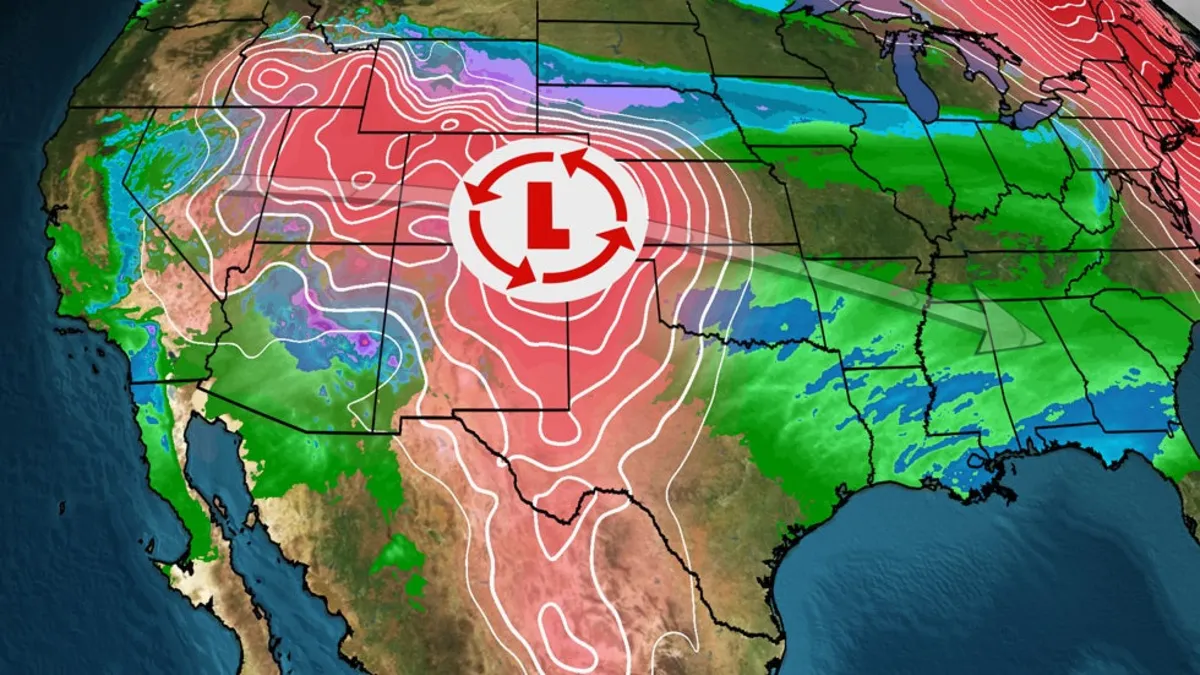
A significant cross-country storm is set to sweep from the West across the Midwest and into the South, bringing a wide range of impactful weather this weekend. Residents can expect conditions that include rain, snow, strong winds, and even a few severe thunderstorms as the storm progresses.
As of now, the storm is already contributing to areas of rain and snow across the Western United States. A radar snapshot indicates that snow will begin to spread eastward, reaching parts of Nebraska, South Dakota, Iowa, and northern Illinois by Thursday night. This early phase of the storm is crucial for those planning to travel through affected areas.
On Thursday, high winds are expected to increase across the Southwest and the Southern High Plains. These winds could pose hazards for travelers, particularly due to the potential for blowing dust that may significantly reduce visibility on highways. Motorists are advised to stay updated on the latest wind speeds in their regions.
As we transition into Friday, the storm will continue to affect the Southwest, where rain and higher-elevation snow will persist. Cities like Phoenix and Tucson in Arizona may experience rainfall, while Flagstaff is expected to receive additional snowfall, which is much needed in that area.
A band of snow, possibly mixed with rain, will extend from Nebraska to Iowa, northern Illinois, southern Michigan, northern Indiana, and northern Ohio. This includes major cities like Des Moines and Chicago, where untreated roads could become hazardous. Therefore, travelers should exercise caution while navigating through these regions.
As the weekend begins, the bulk of this storm will shift toward the South, primarily bringing rainfall. This could dampen outdoor plans on Saturday and Saturday night for areas from Dallas and Oklahoma City to New Orleans. Isolated severe storms may occur, particularly from eastern Texas through much of Louisiana, southern Mississippi, southwest Alabama, and the western Florida Panhandle, potentially producing large hail.
On Sunday and Sunday night, rain and isolated thunderstorms are expected to impact the Southeastern states, including northern and central Florida. This weather could interfere with outdoor activities from Atlanta to Tampa and Charleston, South Carolina.
In terms of snowfall, the heaviest accumulations will occur in the higher elevations of the Rockies and the High Plains of Wyoming, extending to northern Nebraska and southern South Dakota. Areas in these regions can expect totals of 6 inches or more. Conversely, lighter snowfall is anticipated as far east as Chicago, where a few inches may accumulate.
Rainfall in the South is expected to be more of a nuisance than a significant weather event, with widespread totals likely remaining under an inch. However, areas in northern Florida and southern Georgia may see totals exceeding an inch, so residents should remain aware of local forecasts.
In summary, this cross-country storm will bring varied weather conditions across multiple states, so it is essential for residents and travelers to stay informed and prepared for any changes in the forecast as the weekend approaches.