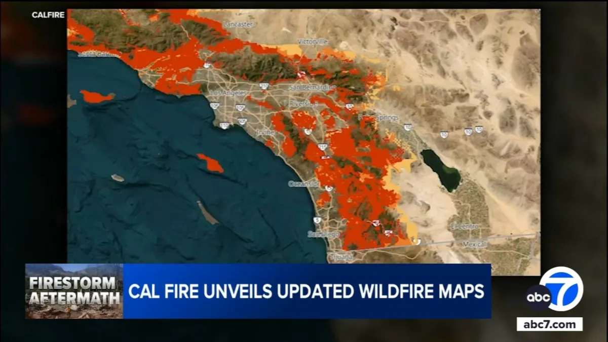
LOS ANGELES (KABC) -- On Monday, Cal Fire unveiled updated wildfire risk maps that illustrate the areas in Southern California most susceptible to wildfires over the coming decades. These maps categorize the risk levels into three distinct groups: moderate, high, and very high. The determination of these categories takes into account various factors including topography, fire weather, flame length, historical fire incidents, vegetation types, and the overall likelihood of wildfires.
The release of these crucial updates is a response to an executive order signed by Governor Gavin Newsom last month, following the devastating Palisades and Eaton fires that occurred in January. This order emphasizes the need for improved fire prevention strategies and enhanced public awareness regarding wildfire risks in the region.
The latest maps reveal a startling statistic: the area classified as very high fire hazard zones across Southern California has expanded by 26% since 2011, growing from 646,838 acres to an alarming 817,212 acres. Overall, the new maps encompass a total of 4.6 million acres categorized under one of the three fire hazard designations, highlighting the increasing threat that wildfires pose to local communities.
According to Chief Daniel Berlant, California state fire marshal, the new fire hazard maps reflect the challenging conditions that firefighters have been encountering in recent years. "This map, and the levels of fire hazard, really just match with the conditions our firefighters have been experiencing for several years now," Berlant stated earlier this month, underscoring the importance of this data for future fire management efforts.
Another critical aspect of these destructive wildfires is the potential health risks faced by firefighters who bravely combat the flames. A study currently underway aims to assess whether the firefighters involved in battling the Eaton and Palisades fires have compromised their long-term health. This research will involve several hundred firefighters and will monitor their exposure to cancer-causing chemicals commonly found in wildfire environments.
Researchers from the Wildfire Conservancy and the University of Arizona are collaborating on this study, utilizing the collected data to draw comparisons between the exposure levels experienced by these firefighters and those faced by fire crews during the tragic events of September 11, 2001, in New York City.
In light of these developments, Los Angeles County Supervisor Kathryn Barger is scheduled to hold a media availability alongside fire officials. This event will focus on the implications of the updated fire hazard maps for local fire prevention measures and the broader impact on Southern California communities.
For more information, see the new fire hazard maps and stay informed about the ongoing efforts to mitigate wildfire risks in the region.